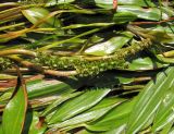
Цветущее растение. Архангельская обл., Вельский р-н, р. Вель. 19 июля 2010 г.
The marker on the map does not indicate the exact coordinates of the plant or lichen.
The marker does only indicate the conditional center of the terrain ("geographic point") where the photo was taken.
Open mapSee also:
Discussion (4)
Code of link to photo
| Create: | HTML or BBCode with preview |
| Code for linking on the web: | |
| This is how it will look: |  Potamogeton × sparganiifolius on the site «Plantarium» |
Text to cite the page
Окатов Г. 2010. Изображение Potamogeton × sparganiifolius Laest. ex Beurl. // Плантариум. Растения и лишайники России и сопредельных стран: открытый онлайн атлас и определитель растений. [Электронный ресурс] URL: https://www.plantarium.ru/page/image/id/65255.html (дата обращения: 02.01.2026).
Okatov G. 2010. Image of Potamogeton × sparganiifolius Laest. ex Beurl. // Plantarium. Plants and lichens of Russia and neighboring countries: open online galleries and plant identification guide. URL: https://www.plantarium.ru/lang/en/page/image/id/65255.html (accessed on 2 Jan 2026).
Views: 1375Discussion
| Denis A. Davydov | По форме листьев и по утолщенному цветоносу очень похоже на P. nodosus, но на севере его вроде бы нет...
Тогда выходит P. gramineus |
| Nikolay Degtyaryov | Не P. nodosus. Единственное, подводные листья бы увидеть поближе. |
| Gennadiy Okatov | Может, P. natans? Подводные листья длинные и узкие. |
| Vladimir Papchenkov | Нет, это не плавающий. У рдеста плавающего, какой-бы форма листовой пластинки не была, всегда присуствует иначе окрашенный (более светлый, желтоватый) верхний участок черешка, который считается выходящей за пределы пластинки частью центральной жилки. Это самый верный полевой признак. Это гибридный рдест P. x sparganiifolius (P. gramineus x S. natans). |