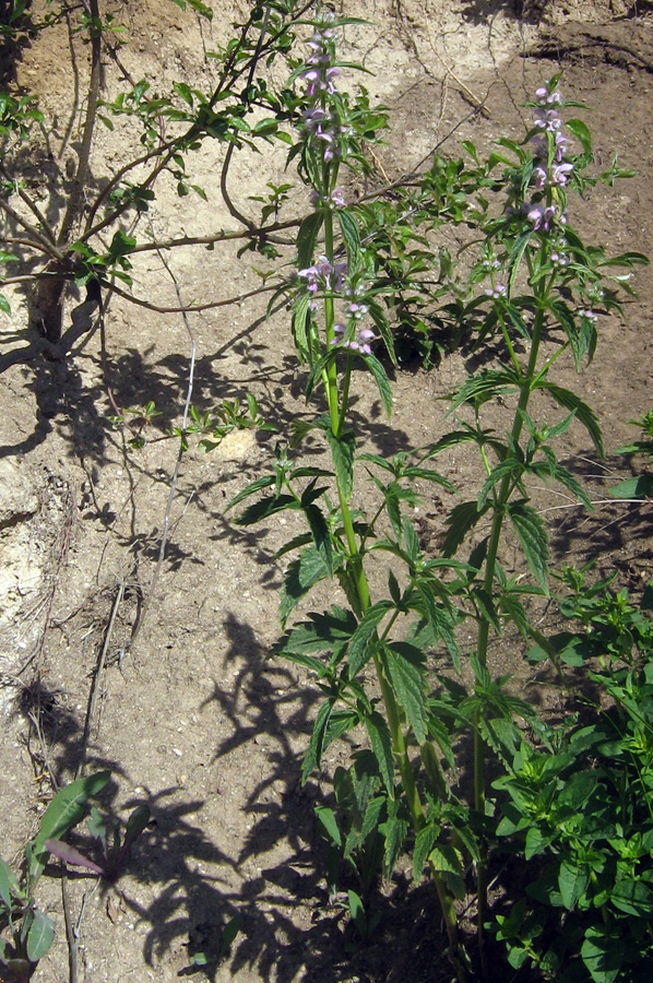
Цветущее растение. Казахстан, Заилийский Алатау, Аксайское ущелье, 1800 м н.у.м. 11.06.2010.
The marker on the map does not indicate the exact coordinates of the plant or lichen.
The marker does only indicate the conditional center of the terrain ("geographic point") where the photo was taken.
Open mapSee also:
Discussion (5)
All photos of taxon (29)
Code of link to photo
| Create: | HTML or BBCode with preview or HTML or BBCode with image compressed to a given width |
| Code for linking on the web: | |
| This is how it will look: |  Stachyopsis oblongata on the site «Plantarium» |
Text to cite the page
Стяжкин И. 2010. Изображение Stachyopsis oblongata (Schrenk ex Fisch. & C.A. Mey.) Popov & Vved. // Плантариум. Растения и лишайники России и сопредельных стран: открытый онлайн атлас и определитель растений. [Электронный ресурс] URL: https://www.plantarium.ru/page/image/id/74420.html (дата обращения: 22.12.2024).
Стяжкин И. 2010. Image of Stachyopsis oblongata (Schrenk ex Fisch. & C.A. Mey.) Popov & Vved. // Plantarium. Plants and lichens of Russia and neighboring countries: open online galleries and plant identification guide. URL: https://www.plantarium.ru/lang/en/page/image/id/74420.html (accessed on 22 Dec 2024).
Views: 1895Discussion
| Vladimir Epiktetov | |
| Vladimir Epiktetov | Игорь, нет ли кадра поближе?
Определение своего фото проверил, все правильно. А с высотой произрастание опять во ФК неувязка, про oblongata пишут, что верхняя граница елового пояса, а у Иващенко указывается и ниже. |
| Игорь Стяжкин | Поищу, может в другом альбоме есть |
| Игорь Стяжкин | Вот еще нашел
 |
| Vladimir Epiktetov | К сожалению здесь тоже и нижних листьев нет и чашечку не видно. |
